Tuesday, June 22, 2021

AN APPROACH TO EMERGENCY PLANNING WITH OPEN SOURCE GIS & IMAGE ALALYSIS TOOLS USING INTERPOLATION TECHNIQUE In the wake of COVID – 19 PANDEMIC Year 2020-2021


Coronavirus is difficult to contain in dense and crowded areas having narrow lanes and streets that makes social distancing a real challenge during times of pandemic and restricts access to light, ventilation and outside view for psychological well being of people. So is the case with the selected study area Hindpiri, which is situated at the core of Ranchi city in India. The Geographic area of Ranchi being 652 sq km has population of 10.7 lakh approx. Hindpiri is a dense area with cultural diversity and mixed socio economic fabric, 1st hit by covid19 in March 2020. 

Hindpiri, may qualify to have implemented planning schemes launched by Government of India like Local Area Plan (LAP) and Town Plan Schemes (TPS) mainly to curb dense urban sprawl, which intensifies most challenges during pandemic times. Land pooling for development through such schemes would require a different strategy due to prevailing CNT and SPT acts (Chhotanagpur Tenancy Act, and Santhal Pargana Tenancy act) on tribal land that imposes restrictions on land transfers.

The project outlines a method to estimate areas of various land use data and built density volumes from satellite image using raster classification and interpolation methods. Then the project focuses on developing a scientific, data driven multi criteria and participatory planning process, Leveraging the strength of GIS and remote sensing that allows addressing all issues of cities related to diverse demographics, culture, socio economic conditions at local levels, existing infrastructure, built environment and land use. In accordance planning recommendations would be made from pandemic point of view. 

Urban sprawl and expansion in a city is controlled by allocating a standard FSI (Floor Space Index), a tool that may be backed with evaluation on multiple criteria’s like existing infrastructure, services, utilities and access types of land parcels.The land parcels would be identified as donor / receiving areas for consuming proposed allowable FSI as incentives in exchange to contributing for creating government’s land bank for providing amenities in lines with LAP scheme. All other design elements would be planned in accordance comprising subdivision of project area into manageable health districts having special access to interconnected underground emergency service corridors, identification of potential convertible urban spaces for transforming into quarantine facilities/ Hospitals, followed by recommendations on Architectural aspects.

Instilling trade of FSI through TDR (Transfer Development Rights) within project area would allow ‘dedensification’ of potential Donor land parcels (having low allowable built density) and ‘densification’ of receiving land parcels (having higher allowable built density) as identified in proposed built density maps. The tribal lands in Jharkhand cannot be sold to nontribal people as per the prevailing CNT and SPT tenancy acts but it may be gifted to government for land pooling / acquisition for providing better amenities, healthcare facilities, public spaces at Hindpiri. 

Cities have limited space hence urban spaces need to be convertible/ transformable and multipurpose. Identified open spaces/ Parks/ existing malls/ offices/ hotels etc may convert into quarantine facilities or emergency health care facilities with use of prefab construction techniques/ 3D printing technologies in construction.


Friday, December 11, 2015

Embrace us all SmartCities - India

Sustainable smart communities or divided Indian societies with few benefiting from innovation in technology and remaining left behind, what do we want? Read More...


Sustainable smart communities or divided Indian societies with few benefiting from innovation in technology and remaining left behind, what do we want? Read More...

Thursday, September 24, 2015

Experimental short film: Street Workout - 2015

Street Work out is exciting and inspiring way to make people realize the importance of fitness. We need more such facilities in our parks and gardens and open spaces. Read More...

Resort concept site plan with traditional earth construction, Kutch - 09/2015

Elevation design and other design Models


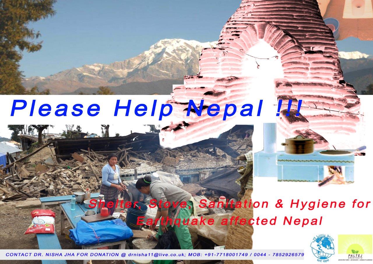
Rehab project proposal for earthquake affected Nepal - 2015


Story
The powerful 7.9-magnitude earthquake killed more than 8000 people in Nepal. About 1,60,786 houses and 1,383 schools are destroyed affecting atleast26 districts. There is an urgent need of people across the world to get together in Rebuilding Nepal. Some NGOs are working on it but considering the scale of devastation, more help is needed urgently. This project will be led by Paltej Archiects in association with Sano Paila (A little Step), a local NGO in Nepal. Sano Paila has been working at a grass roots level for last 8 years. The NGO has been actively involved in rescuing children from human trafficking and drug trafficking/abuse. They build local libraries and community centers to strengthen the relationship between rural communities on a national scale. Have conducted many free medical camps in remote rural areas and have distributed free medicines and counseling. They have clear goal towards helping people in all ways and are competent with their local knowledge, skills, ability to reach and communicate in remote areas of Nepal. So far Sano Paila has taken a lot of initiatives and has distributed thousands of tents, blankets, food items, water and also conducted medical camps in remote earthquake affected villages. Currently Sano Paila is working in rebuilding temporary houses in Gorkha that was the epicenter of earthquake. The needs have been identified and now there is urgent requirement for more sturdy housing, Stoves for cooking and toilets. These are the very basic facilities that people need immediately as monsoon is very close and lack of same may cause mass health hazard. 10000 affected People in Nepal have not even recovered the posttraumatic stress after the devastating earthquake and now are hurdled to cope for very basic needs of food, shelter, hygiene and sanitation. I was shocked to learn about an incident where a generous donar in Mumbai has been vigorously following up for relief goods to reach Nepal that she had sent 20 days back and it has still not reached the needy ones due to lengthy custom clearance process. It’s sad that all food items have gone bad and are getting wasted in cargos as they would reach the affected people after they have starved for minutest help. We have worked out possible solutions to meet with these basic needs that are cost effective, eco friendly, less labour intensive and speedy to implement with locally available resources. We have divided our project in phases. We are starting with Sindhupalchok and Dolkha. Both places having more than 2000 destroyed homes. Due to lack of proper housing, sanitation (toilets) and nutritious food as cooking facility is unvailable , people are at higher risk of communicable diseases and malnutrition. At this difficult time, we would heartily request for your genuine help for the people of Nepal. Let us join hands together and help these people to resettle once again. Friends please help Nepal Rebuild!! Many people want to help Nepal at this moment and you can do that through us.

Design Presentation: Prefabricated Prop Studio - 2014


Design Presentation: Prefabricated Prop Studio - 2014


Monday, April 20, 2015

Building Density (BUP) vs Road - using GIS and Satellite Imagery 2015

This project is explored in a section (Nagdevi) of ward B of Municipal Corporation Greater Mumbai, India. There are number of ways Building densities affect city's health. Aim of this project is to understand road proportion with respect to total consumed Built up (BUP) of an area using GIS and Satellite Imagery. This will help planners understand existing scenarios better for taking correct decisions when it comes to revising FSI for Mumbai.


Sunday, December 22, 2013

Architecture and Site Planning works with Aamby Valley City 2011-2014

Planning and Architectural Design works


Architecture & Planning Works

Architectural Model with Sketchup


Portfolio Link

<embed src="http://www.box.net//static/flash/box_explorer.swf?widget_hash=flb050jotz&v=0&cl=0" width="460" height="345" wmode="transparent" type="application/x-shockwave-flash"></embed>


Wednesday, September 15, 2010

GIS Based Sustainable Growth Model for South College Station, TX - Video Presentation 2010

GIS based Site Suitability Analysis (Participatory Approach) click to view video presentation

March-September 2010: GIS Based Sustainable Growth Model for South College Station. Work experience with the city of College Station,TX. A video presentation can be viewed on Youtube.

This project has developed a growth model for south College Station area, exploring the viability of incorporating sustainable development concepts in a real world scenario. The methodology involves participatory approach for multi objective decision making with GIS based analytical process. The project uses analytical hierarchy process in map overlays and map algebra for locating community swimming facility; uses vector analysis for incorporating street furniture on bike and pedestrian ways and for finding target areas to implement sustainable energy practices. 

The project recommends strategies for developing the upcoming south College Station area through the defined goals and objectives attributing to the cause of sustainable development in an incremental way, and then using them in a GIS based analysis for practical implications. The goals and objectives in compliance with the comprehensive plan 2009 have made sustainable and cost effective recommendations. The project's is to identify the most favorable site for the allocation of a community swimming facility against many upcoming private pools, addressing the issue of water conservation in the city of College Station. The site suitability analysis based on Analytical Hierarchy Process has been used for this goal using the criteria of land use plans, walkibility to the existing neighborhoods, proximity to the new development areas, access to the main roads and market land values in GIS based modeling. The participatory approach in this analysis has helped achieve unbiased results in the weighted overlay map outputs.

The second goal aims for identifying sites for installing street furniture that will also suffice the need of natural surveillance on streets. The installation is planned in a prioritized manner by conducting GIS based vector analysis for this goal. The installation will take place dispersively in phases for benefiting a larger population in one go than pouring the initial resources in a concentrated area. Recycled materials are recommended to be used for the construction at the least possible cost and solar powered advertisement billboards have also been recommended on some of the street furniture for recovering the cost in the long run.

Conclusion: The GIS based sustainable growth model for the south of College station is a strategy based planning method which focuses on project viability in terms of cost, time and resources. Issues of water conservation, environment, neighborhood safety and aesthetics are tackled by using GIS based modeling with raster and vector calculations. Multi Objective Decision making, using Single Output Map Algebra (SOMA) was used with a participatory approach in evaluating scores by pair wise comparison in the analytical hierarchy process that has brought less biased results in map outputs.

Saturday, April 17, 2010

Model Making for Participatory Planning Approach 2008


While rendering many great planning concepts to reality, we planners have often been unsuccessful in involving people's participation to a great extent. Many great neighborhoods designed have come to reality with failures or success, but without full satisfaction of people actually living there. Introducing ways of encouraging people's participation in planning neighborhoods is very essential for shaping our urban fabric in a way that majority appreciates and enjoys the built environment rather than a few admiring and rest taking the brunt. A lot many efforts have already been made to reach out to peoples preferences through surveys and research but yet what is really missing is, direct participation of people in design process for better satisfactory results. The technology of virtual reality, where a user can interact with computer simulated environment gives a good scope for involving third person's opinion in design. This technology provides visual experiences, displayed either on computer screens or through stereoscopic displays. However these techniques are not easy to avail when large audiences are expected to vote. 

Harrison County comprehensive planning process has explored a simple but yet very effective way of reaching to people's view on designing their neighborhood. A detachable model blocks system is made for the master plan, which can be laid in many ways on model base(Printed master plan) for trying various compositions of layouts in 3D. This allows better visualization for people to see their neighborhood design at a smaller scale in three dimensions and gives them a chance to rethink of what they want. This concept of toy modeling is faster and easy to play with, providing various design options by encouraging public participation. Planners can develop and evolve certain prototypes of design on a master plan based on people's participation by playing with these building toys. The toy building blocks can be given to people to rearrange on a part of master plan and their preferences can be recorded. The most common preferences thus can be included by designers for planning the neighborhoods. This way there will be more choices people can opt for their built environment before it is simply imposed in their neighborhood by planners and decision makers. People's participation will bring better results thus inculcating strong feeling of belonging to the neighborhood as they would have had their roles in designing it.

I had first tried this concept of modeling in a class I took in summer 2008 to explore and understand computer aided design resulting in computer aided manufacturing processes. (figure1&2) 3D models were created to first analyze the best possible detailing for the detachable models and then the model blocks were made with wood, using laser cutter, table saw and hand saw. However I came to know through my professor, Jennifer Evans Cowley a similar modeling system made by Richard McLaughlin in 2004 (Figure3).With her advice, I used the same process to produce the model blocks for Harrison County including all scaled dimensions of commercial, residential and institutional building blocks. A total of 1235 blocks were cut from Pine wood that made one complete model kit for a part of neighborhood. The model Kit was used at the Lyman Elementary School to engage children in thinking about and planning for their community (Figure 4&5). It was also used in a regional planning commissioner training session allowing the planning commissioners to work together to imagine their communities future. The remaking of this model system for Harrison County master plan helped people get a chance to visualize and reform their community spaces as they liked and not simply get restrained to accept what has been drafted by a few people in a Comprehensive plan. We hope this will help develop more interactive design options for communities by encouraging people's participation in many more planning models.

Interior Works 2007